Explore the fundamentals of point clouds and Lidars — how they differ, their file formats, advantages, and much more.
Point clouds play a vital role in modern 3D modeling and spatial data analysis. They are foundational in applications ranging from autonomous driving to archaeology, offering detailed and accurate representations of real-world environments. In this article, we’ll explore what point clouds are, examine Lidar point clouds in depth, and discuss their importance and diverse uses across industries.
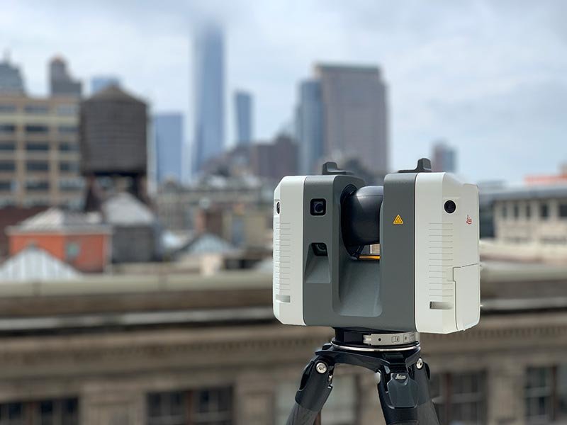
What is a Lidar Sensor?
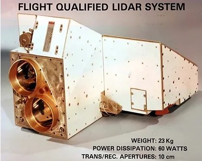
Lidar has transformed the way we capture and interpret data about our surroundings. These sensors use concentrated beams of light to measure distances between objects and construct three-dimensional maps of an environment. By emitting rapid pulses of light and recording the time it takes for each pulse to return, Lidar systems generate highly accurate point cloud models of the scanned area.
A Brief History of Lidar
The concept of Lidar first emerged in the 1960s, but it was not until the 1980s that the technology became practical for remote sensing. Early applications focused primarily on topographic mapping and terrain analysis. As laser and sensor technologies evolved, Lidar became capable of capturing more precise and detailed data, driving adoption in fields such as urban planning, forestry, and archaeology.
In recent years, compact and affordable solid-state Lidar systems have fueled widespread use in industries like autonomous vehicles, where precision and reliability are critical.
What is a Point Cloud?
A point cloud is a collection of data points defined in a 3D coordinate system. Each point represents a precise location (X, Y, Z) and collectively forms a cloud-like dataset that outlines the shape or surface of an object, structure, or landscape in remarkable detail.
Key Characteristics of Point Clouds
- 3D Coordinates: Each point is defined by X, Y, and Z values.
- Density: Higher density means finer detail and resolution.
- Color and Intensity: Some point clouds store extra data, such as RGB color or intensity values, adding more context and realism to spatial data.
How Are Point Clouds Generated?
Point clouds can be produced using several techniques:
- Laser Scanners: Emit laser pulses to measure distances and generate highly accurate 3D models.
- Photogrammetry: Uses overlapping 2D images taken from multiple angles to reconstruct 3D geometry.
- LiDAR (Light Detection and Ranging): Employs laser pulses to measure variable distances, producing the most precise and extensive 3D data among all methods.
Lidar vs. Point Cloud
Lidar is the technology that uses lasers to scan and collect data, while a point cloud is the resulting dataset. In other words, Lidar captures the data; the point cloud is the visual representation of that data.
While Lidar focuses on data acquisition, point clouds serve as the basis for modeling, analysis, and visualization.
Key Characteristics of Lidar Point Clouds
- High Precision: Exceptional spatial accuracy for detailed modeling.
- Speed: Rapidly scans large areas, ideal for surveying and forestry.
- Versatility: Effective across terrestrial, aerial, and even underwater environments.
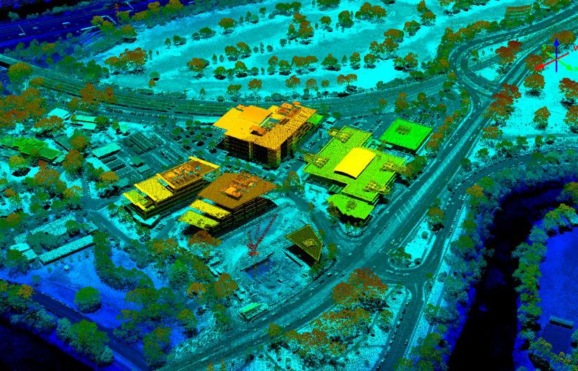
The Significance of Point Density
Point density—how many points are captured per unit area—determines the level of detail in a Lidar dataset. Similar to image resolution, higher density results in a more accurate 3D model. This is especially critical for applications such as mapping, construction planning, and environmental monitoring, where precision is essential for informed decision-making.
Lidar Point Cloud Data Formats
Different industries rely on various file formats to store and process Lidar point clouds:
- LAS: Common for aerial point clouds collected by drone or aircraft-mounted Lidar systems, widely used in surveying and forestry.
- PCD: The most popular format for Lidar point clouds, available in ASCII or Binary; the latter is preferred for large datasets due to smaller file sizes.
- PLY: Similar in structure to PCD, this format stores both metadata and the actual 3D data points.
Colorizing Lidar Point Clouds
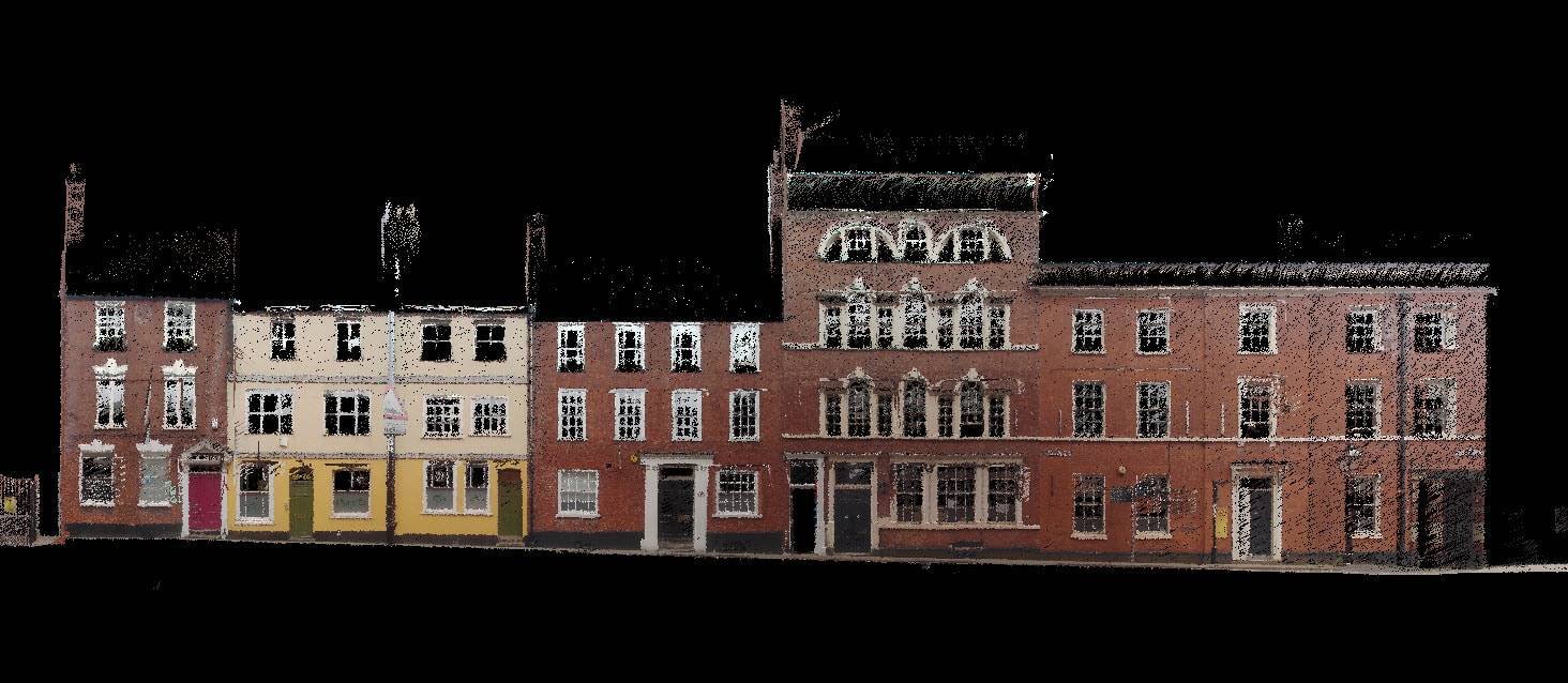
Raw Lidar data is typically grayscale since Lidars only capture spatial information. Adding RGB color data enriches visualization and aids in analysis.
Colorization can be achieved by aligning (registering) Lidar data with imagery from cameras, projecting color information onto the corresponding points, or by synchronizing sensors so both datasets are captured simultaneously.
Multi-Sensor Fusion of Lidar and Cameras
Multi-sensor fusion combines inputs from various sources—like Lidars, cameras, and radars—to build a richer understanding of the environment. This approach compensates for the limitations of individual sensors, enhancing accuracy and situational awareness. Such systems are increasingly used in autonomous vehicles, robotics, and defense technologies.
Advantages of Lidar Point Clouds Over Traditional Sensors
- Capture high-resolution 3D data with precise measurements.
- Operate effectively in both day and night conditions.
- Detect objects at longer ranges compared to photogrammetry or standard optical sensors.
These qualities make Lidar point clouds ideal for advanced applications such as self-driving cars and aerial mapping.
Challenges of Lidar Point Clouds
Despite their benefits, Lidar point clouds present several challenges:
- High Cost: Equipment and data processing remain expensive.
- Data Volume: Massive datasets require significant storage and computational resources.
- Noise and Outliers: Data must be filtered to ensure accuracy.
- Integration Complexity: Combining point clouds with other spatial data (like 2D imagery) can be technically demanding.
Applications of Lidar Point Clouds
Autonomous Driving
- Environment mapping for navigation
- Obstacle detection and avoidance
Construction and Architecture
- Building Information Modeling (BIM)
- Site analysis and topographic surveying
Forestry and Environmental Monitoring
- Forest inventory and canopy analysis
- Terrain and erosion monitoring
Urban Planning and Infrastructure
- 3D city modeling and simulation
- Utility and transport network mapping
Archaeology
- Digital preservation of historical sites
- Discovery of hidden or buried structures
Parting Thoughts
Lidar point clouds represent one of the most powerful ways to capture and analyze 3D spatial information. They enable unparalleled precision across industries—from autonomous mobility and construction to conservation and archaeology.
As Lidar technology continues to evolve, so too will the scope of its applications. At Coral Mountain, we specialize in processing, annotating, and enriching Lidar point clouds to help clients extract maximum value from their 3D data—driving innovation, insight, and smarter decision-making across sectors.
Coral Mountain Data is a data annotation and data collection company that provides high-quality data annotation services for Artificial Intelligence (AI) and Machine Learning (ML) models, ensuring reliable input datasets. Our annotation solutions include LiDAR point cloud data, enhancing the performance of AI and ML models. Coral Mountain Data provide high-quality data about coral reefs including sounds of coral reefs, marine life, waves….