Introduction
LiDAR, radar, and sonar are three foundational remote sensing technologies, each operating based on a distinct physical principle to collect information about the surrounding environment.
- LiDAR (Light Detection and Ranging) uses light waves,
- Radar (Radio Detection and Ranging) uses radio waves, and
- Sonar (Sound Navigation and Ranging) uses sound waves.
Although they all share the common goal of detecting objects and measuring distance, the inherent differences in wave types lead to unique advantages, limitations, and application domains for each technology.
This analysis explores their operating principles, technical characteristics, and performance comparisons.
LiDAR (Light Detection and Ranging)
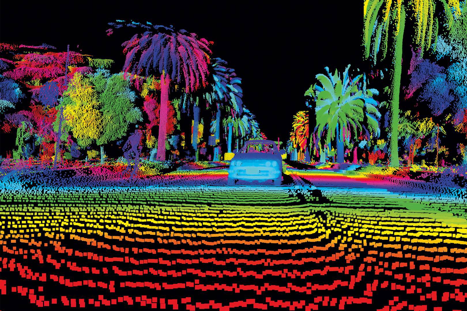
Terrestrial LiDAR systems are installed on moving vehicles or tripods on the earth surface for collecting accurate data points
LiDAR operates by emitting laser pulses and measuring the time it takes for those pulses to travel to an object, reflect, and return to the sensor. Based on the Time of Flight principle, LiDAR can generate highly accurate 3D models of the environment.
- Laser technology: LiDAR systems typically use lasers in the infrared or ultraviolet spectrum. The use of short-wavelength light enables superior spatial resolution, allowing the detection of very fine details.
- LiDAR point cloud: The raw data output from LiDAR is a set of spatial points in three dimensions, known as a point cloud. Each point represents a position on the scanned surface. These point clouds may contain millions or even billions of points, providing extremely detailed digital reconstructions of objects or terrain.
- High resolution: This is LiDAR’s most notable technical advantage. Its ability to create detailed maps with centimeter- or even millimeter-level accuracy makes it indispensable in high-fidelity applications like terrain mapping, structural inspection, and autonomous vehicle navigation.
Radar (Radio Detection and Ranging)
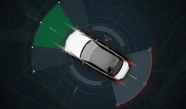
Radar has many benefits for self-driving cars. It does a great job of preventing collisions, providing parking assistance, and powering cruise control systems.
Radar emits radio waves and analyzes reflected signals (echoes) to determine an object’s position, distance, and velocity.
- Radio waves: Radio waves have much longer wavelengths than light, allowing them to penetrate adverse atmospheric conditions such as rain, fog, dust, and snow. This gives radar systems stable performance in all weather conditions.
- Velocity measurement: A unique feature of radar is its ability to measure the relative speed of an object using the Doppler effect. By analyzing frequency shifts in the reflected waves, radar can accurately determine whether an object is moving toward or away from the sensor and at what speed.
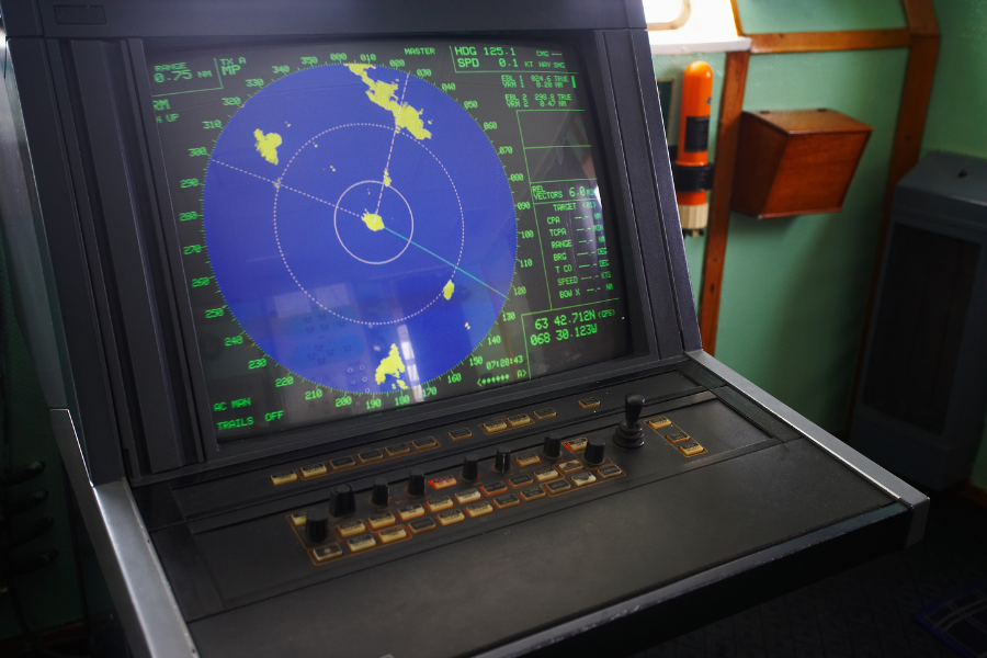
- Long-range operation: Because radio waves experience minimal atmospheric attenuation, they can travel great distances. This makes radar the preferred technology for long-range applications such as air traffic control, maritime surveillance, and weather forecasting.
Sonar (Sound Navigation and Ranging)
Sonar relies on sound waves to detect objects, primarily underwater.
Sonar operates by transmitting and receiving sound waves and is primarily used in underwater environments, where electromagnetic waves (light and radio) are quickly absorbed.
- Sound waves: Sonar systems emit acoustic pulses (pings) and listen for echoes. The return time of the sound pulse is used to calculate the distance to the object.
- Underwater accuracy: In water, sonar can measure distance, depth, and object size with high precision. However, its performance can be affected by environmental factors such as water temperature, salinity, and background noise.
- Detailed mapping: Modern sonar systems, especially multibeam sonar, can scan a wide swath of the seafloor with each pulse, enabling detailed 3D models of underwater terrain, structures, or shipwrecks.
Comparison of LiDAR, Radar, and Sonar by Key Characteristics
| Criteria | LiDAR | Radar | Sonar |
| Detection Principle | Laser reflection | Radio wave reflection | Sound wave reflection |
| Distance Measurement | Time of flight of laser pulse | Time of flight of radio wave | Echo time of sound wave |
| Resolution | Very high (fine details) | Medium to low | Medium (underwater detail) |
| Range | Medium (a few km), affected by atmosphere | Very long (hundreds of km) | Limited by water environment |
| Environmental Impact | Sensitive to rain, fog, dust | Performs well in all weather | Sensitive to water noise and turbulence |
| Wave Type | Light wave (laser) | Radio wave | Sound wave |
| Cost | High | Medium | Varies (low to very high) |
Sensor Fusion
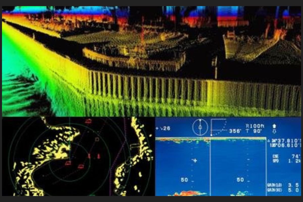
Sensor fusion of data from LIDAR, Radar and Sonar can greatly enhance the efficacy of these sensors. (Source: Bayfront Maritime Center -Simulator Training).
In practice, no single sensor technology is perfect. Each has blind spots and limitations. Therefore, a more effective approach is to combine data from multiple sensors to build a more comprehensive and reliable perception system.
Integrating LiDAR, radar, and sonar (along with cameras) allows a system to leverage the strengths of each technology to compensate for others’ weaknesses. For example, in an autonomous vehicle:
- LiDAR provides detailed 3D mapping of the surroundings,
- Radar supplies velocity and distance data under poor weather conditions,
- Cameras deliver color and object recognition (e.g., traffic signs).
This fusion creates safety redundancy and a richer situational awareness than any single sensor could provide on its own.
Applications of LiDAR, Radar, and Sonar
- LiDAR: Autonomous vehicles (mapping and object detection), industrial automation (volume measurement), archaeology (mapping obscured sites).
- Radar: Aviation and maritime (monitoring and weather tracking), traffic enforcement (speed detection), autonomous vehicles (long-range object detection and speed measurement).
- Sonar: Marine biology (tracking populations), underwater archaeology, oceanography, submarine navigation.
Conclusion
LiDAR, radar, and sonar are the three pillars of remote sensing technologies, each possessing distinct technical characteristics suitable for specific environments and applications.
- LiDAR excels in resolution and detail.
- Radar stands out for its long-range and all-weather capability.
- Sonar is irreplaceable for underwater operations.
Understanding these differences is crucial for engineers and developers to select and integrate the most appropriate sensing systems to meet the demanding requirements of land, air, or underwater applications.
Coral Mountain Data is a company providing high-quality data labeling services for artificial intelligence (AI) and machine learning (ML) models. Our solutions include processing and labeling LiDAR point cloud datasets, helping deliver high-quality input data that enhances the performance of your models.