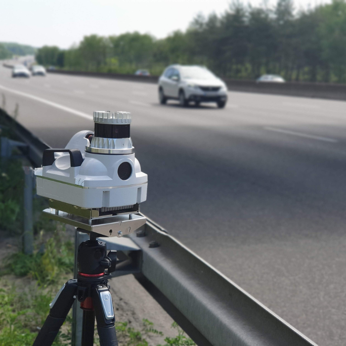
Understand how far Lidar sensors can detect and the factors that influence their range, including sensor specifications, atmospheric conditions, and technological advancements.
LiDAR (Light Detection and Ranging) is an advanced remote sensing technology that uses laser pulses to measure distances with high precision. Today, it plays a critical role across many industries-from autonomous mobility and smart infrastructure to environmental and atmospheric analysis. One of the most important performance parameters of any LiDAR system is its detection range.
How far a LiDAR sensor can detect objects depends on a combination of technical specifications, environmental influences, and system-level design choices. This guide explores the key factors that affect LiDAR range and provides a practical understanding of how different configurations perform across real-world applications.
Factors Influencing LiDAR Detection Range
LiDAR Sensor Specifications
The internal design and technical capabilities of a LiDAR sensor are the primary drivers of detection range. Several specifications directly influence how far a system can reliably detect objects:
- Power Output
Higher laser power enables stronger signal returns, allowing objects to be detected at greater distances. - Wavelength
LiDAR systems typically operate using infrared or visible light wavelengths. Infrared wavelengths are often better suited for penetrating dust, smoke, or haze, making them more effective in certain environments. - Sensor Sensitivity
A highly sensitive receiver can detect weaker reflected signals, extending the detection range-especially for distant or low-reflectivity targets.
A LiDAR system that combines strong output power, an application-appropriate wavelength, and high receiver sensitivity will generally achieve superior range performance.
Atmospheric Conditions
Environmental factors play a significant role in limiting or extending LiDAR range. Conditions such as fog, rain, snow, or airborne particles can interfere with laser propagation:
- Fog and rain scatter laser pulses, reducing signal strength and limiting effective range.
- Dust and smoke can absorb or deflect laser energy, further degrading detection distance.
For deployments in challenging weather or industrial environments, LiDAR systems must be designed to mitigate atmospheric signal loss through optimized wavelengths and processing techniques.
Object Reflectivity
The surface properties of detected objects also affect LiDAR range. Reflectivity determines how much of the emitted laser energy is returned to the sensor:
- Highly reflective surfaces (such as metal or light-colored materials) produce stronger returns and can be detected from farther distances.
- Low-reflectivity surfaces (dark, matte, or absorbent materials) return less energy, limiting detection range.
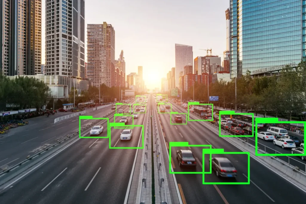
In applications like autonomous driving or traffic monitoring, understanding the reflectivity characteristics of typical targets is essential for system optimization.
System Use and Configuration
How a LiDAR system is configured and deployed can significantly influence its effective range:
- Field of View (FOV)
A wider FOV increases spatial coverage but may reduce range resolution due to laser energy being distributed over a larger area. - Angular Resolution
Higher angular resolution improves object detail and classification but can slightly reduce maximum range.
Systems designed for large-scale mapping often prioritize range, while those used in autonomous navigation emphasize precision and spatial accuracy.
Technological aspects affecting detection range
Time of Flight
LiDAR measures distance by calculating the time it takes for a laser pulse to travel to an object and return-known as time of flight. The precision of these measurements directly affects detection range.
- More accurate timing systems allow for longer and more reliable detection.
- Shorter pulse durations improve distance resolution and help distinguish objects at varying depths.
These capabilities are especially important in safety-critical applications such as autonomous vehicles.
Signal Return and Processing
Advanced signal processing techniques play a crucial role in extending LiDAR range. By improving the signal-to-noise ratio, modern systems can extract usable data even from weak or partially obstructed returns.
- Multi-return processing allows detection of multiple surfaces along a single laser path, such as vegetation layers or urban structures.
- Sophisticated filtering algorithms help isolate meaningful reflections from background noise.
Laser Pulse Characteristics
The frequency and duration of laser pulses influence both range and resolution:
- Higher pulse frequencies enable detailed scanning at shorter distances.
- Longer pulses can extend detection range but may reduce spatial resolution.
LiDAR system designers balance these characteristics based on the intended application.
Comparative analysis with other technologies
LiDAR vs. Radar
Although both LiDAR and radar measure distance, they operate using fundamentally different principles:
- LiDAR uses laser light, offering high-resolution and precise spatial data, but with reduced performance in extreme weather.
- Radar uses radio waves, enabling longer-range detection and better performance in poor atmospheric conditions, though with lower spatial resolution.
As a result, radar is often favored for long-range surveillance, while LiDAR excels in applications requiring fine detail and accuracy, such as autonomous navigation.
Airborne LiDAR
Airborne LiDAR systems are commonly used for topographic mapping, forestry analysis, and environmental monitoring. These systems operate from aircraft or drones and require specialized configurations:
- Altitude considerations demand higher-powered lasers to maintain range.
- Wide-area coverage requires balancing detection range with sufficient resolution to capture terrain details accurately.
Applications and Use Cases
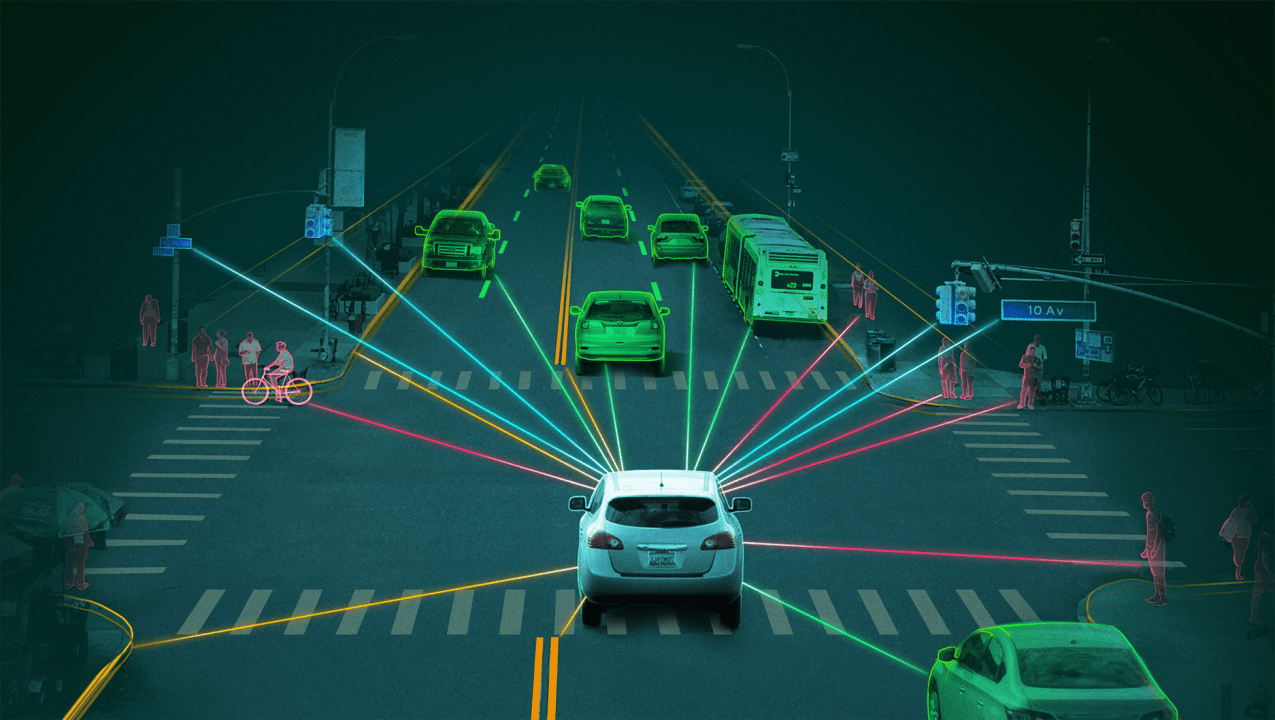
Autonomous Vehicles
In autonomous driving, LiDAR detection range directly impacts safety and decision-making:
- Long-range detection enables vehicles to anticipate hazards and react safely at high speeds.
- Short-range precision supports accurate mapping for lane positioning, parking, and obstacle avoidance.
Environmental Monitoring
LiDAR is widely adopted for large-scale environmental analysis:
- Forestry and agriculture benefit from detailed terrain and vegetation models derived from long-range LiDAR scans.
- Atmospheric studies use LiDAR to analyze clouds, pollutants, and airborne particles across wide areas.
Conclusion
The effective detection range of a LiDAR system is shaped by multiple interconnected factors, including sensor power, wavelength, atmospheric conditions, object reflectivity, and system configuration. Continuous advancements in laser design, signal processing, and system integration are steadily extending LiDAR’s capabilities.
From autonomous vehicles and airborne mapping to environmental monitoring, understanding these range-influencing factors is essential for selecting and optimizing LiDAR systems across diverse applications. As supported by advanced data and AI workflows from organizations like Coral Mountain, LiDAR technology continues to evolve-unlocking greater accuracy, reliability, and real-world impact.
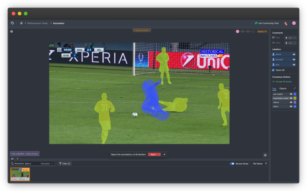
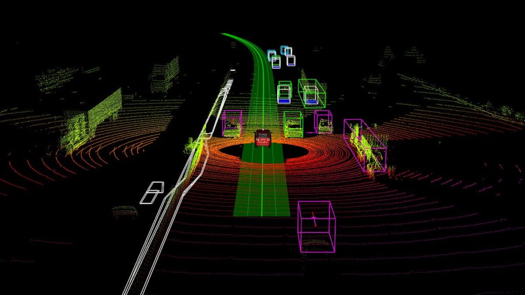
Coral Mountain Data is a data annotation and data collection company that provides high-quality data annotation services for Artificial Intelligence (AI) and Machine Learning (ML) models, ensuring reliable input datasets. Our annotation solutions include LiDAR point cloud data, enhancing the performance of AI and ML models. Coral Mountain Data provide high-quality data about coral reefs including sounds of coral reefs, marine life, waves….