We take a comprehensive look at how Lidars operate, what types of Lidars exist, what advantages they offer, and where they are used.
Lidar – short for Light Detection and Ranging – is a remote sensing technology that has rapidly evolved over the past decade, becoming a critical component in industries such as autonomous driving, surveying, forestry, archaeology, and infrastructure inspection.
A Lidar system works by emitting laser pulses and measuring the time it takes for the light to return after reflecting off objects. This time-of-flight information is used to calculate precise distances and generate high-resolution 3D point clouds of surrounding environments. In this article, we’ll explore what a Lidar scanner is, how it operates, the types available today, its limitations, and its most important applications.
What is Lidar?
Lidar is a technique that uses laser beams to determine distances and reconstruct the physical world in 3D. Sometimes referred to as laser radar or laser scanning, it operates by firing rapid laser pulses toward a surface and then measuring the return signal.
Depending on the platform, Lidar systems can be divided into:
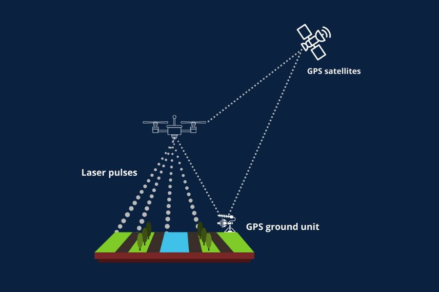
- Airborne Lidar – deployed on drones, helicopters, or aircraft for large-scale terrain and forestry mapping.
- Terrestrial Lidar – mounted on vehicles, tripods, or handheld units for scanning from the ground.
Modern systems use a variety of wavelengths-from ultraviolet to near-infrared-depending on whether they are meant to map land, vegetation, or even shallow water.
What is a Lidar Scanner?
A Lidar scanner is the physical device that emits and captures laser pulses. It is the hardware implementation of the Lidar method.
To put it simply:
- Lidar refers to the technology or technique.
- Lidar scanner refers to the device that performs the measurement.
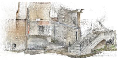
The output of a scanner is a point cloud – millions of spatial points representing surfaces in 3D.
How Lidar Works – Principles of Operation
Lidar operation is based on a simple yet highly precise process:
- Laser Emission – The scanner fires rapid laser pulses.
- Reflection – The pulses strike an object and reflect back.
- Time-of-Flight Measurement – The return time is used to calculate distance.
- Point Cloud Formation – Each pulse becomes a point in 3D space.
- Optional Data Layers – Some systems also capture intensity or RGB color information.
This process happens hundreds of thousands of times per second, enabling extremely dense 3D reconstructions.
Lidar Detection Range, Resolution and Field of View (FOV)
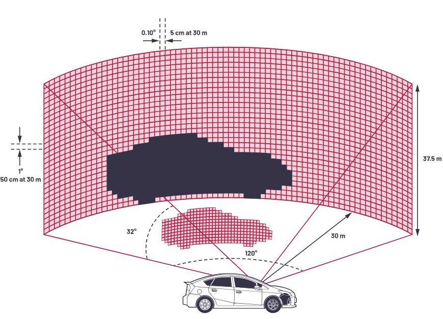
Three core specifications determine Lidar performance:
Detection Range
The maximum distance at which accurate measurements can be obtained. Influenced by laser strength, target reflectivity, and weather conditions.
Resolution
Defines the level of detail in the scan. It includes:
- Angular Resolution – Determines how closely two points can be distinguished horizontally or vertically.
- Range Resolution – Defines the ability to separate two objects at different distances.
Field of View (FOV)
The angular coverage of the scanner.
- Horizontal FOV – Determines panoramic coverage (e.g., 360° in some automotive sensors).
- Vertical FOV – Crucial for detecting overhead or below-ground features, especially in aerial mapping.
Types of Lidars
Lidar systems can be classified based on operating method and mounting platform.
By Method of Operation
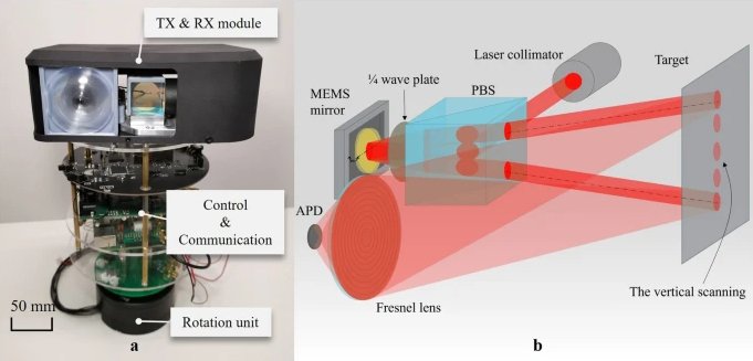
- Mechanical Lidar – Uses rotating mirrors; reliable but bulky and has moving parts.
- Solid-State Lidar (MEMS / OPA) – Compact and durable with no moving parts; widely used in modern robotics and smartphones.
- Flash Lidar – Illuminates an entire scene at once; generates 2D or low-density 3D images quickly.
- FMCW Lidar – Uses frequency-modulated beams; offers high precision and velocity detection but remains more complex and costly.
By Mounting Platform
- Airborne Lidar – Mounted on aircraft for large-area surveying.
- Bathymetric Lidar – Specialized for underwater terrain scanning using green/blue wavelengths.
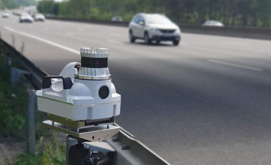
- Terrestrial / Mobile Lidar – Installed on vehicles or tripods for infrastructure and urban mapping.
- Handheld Lidar – Compact devices used in construction, archaeology, and forensics.
- Smartphone Lidars – Found in modern devices like the iPhone 12 Pro and above; used for AR and quick scanning tasks.
Can Lidar Penetrate Fog?
Lidar performs better than cameras in low-visibility conditions, but dense fog, heavy rain, and snow still scatter laser beams, reducing range and accuracy. Some systems are optimized for adverse weather, but no Lidar can completely overcome optical scattering.
Limitations of Lidar
Despite its power, Lidar has notable drawbacks:
- High Cost – Especially for long-range high-resolution units.
- Data Processing Requirements – Point clouds are data-heavy and demand strong computing resources.
- Environmental Interference – Fog, dust, and reflective surfaces can degrade performance.
Lidar vs Radar vs Photogrammetry
Lidar isn’t the only method for 3D mapping. It is often compared to:
- Radar – More robust in extreme weather but offers lower resolution.
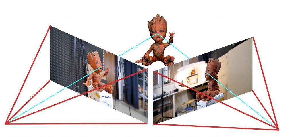
- Photogrammetry – Uses images to reconstruct 3D shapes; affordable but dependent on lighting and less accurate than Lidar.
Where is Lidar Used?
Lidar has become a standard tool across industries:
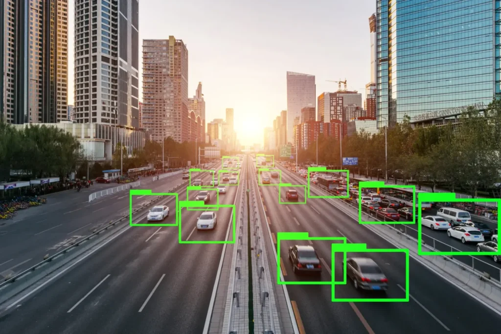
- Autonomous Vehicles – Real-time obstacle detection and scene reconstruction.
- Forestry and Environmental Monitoring – Canopy analysis and biomass estimation.
- Topography and Civil Engineering – Elevation models for surveying and planning.
- Archaeology – Reveals hidden structures beneath vegetation.
- Mining and Geology – Terrain modeling and structural monitoring.
- Urban Planning and Infrastructure Inspection – Structural health assessment and digital twin creation.
- Security and Surveillance – Perimeter detection and tracking.
Conclusion
Lidar is one of the most transformative sensing technologies of our time. Its ability to generate precise, real-time 3D representations makes it indispensable in domains ranging from transportation to environmental science. With continuous improvements in cost, miniaturization, and AI-powered processing, Lidar is quickly moving from specialized equipment to mainstream adoption – from aircraft and robots to pocket-sized consumer devices.
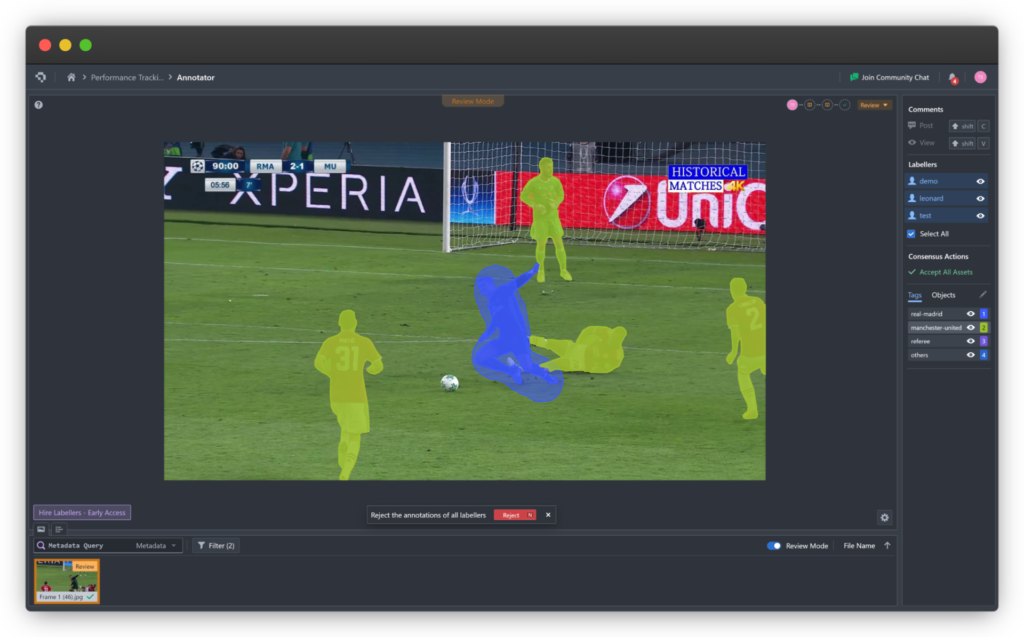
Coral Mountain Data is a data annotation and data collection company that provides high-quality data annotation services for Artificial Intelligence (AI) and Machine Learning (ML) models, ensuring reliable input datasets. Our annotation solutions include LiDAR point cloud data, enhancing the performance of AI and ML models. Coral Mountain Data provide high-quality data about coral reefs including sounds of coral reefs, marine life, waves….